A strategy map has two jobs that often fight each other. It must create the feeling of a believable place, and it must make ownership, movement and danger immediately understandable. Lane Wars is being built by treating those as one design problem.
Starting with geography
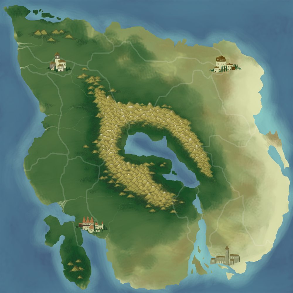
The world illustration establishes the large shapes first: coastlines, a central mountain ring, lakes, distant settlements and roads that cross very different terrain. These features give the campaign natural regions and chokepoints before province borders or interface panels are added.
Mountains are not only decoration when they explain why armies use certain roads. A remote city feels different when its approaches pass through a narrow route. Coastal settlements suggest sea connections and trade even while those systems are still future work.
Turning a painting into a campaign
The playable layer divides the realm into provinces with explicit adjacency. Armies move between connected neighbors instead of travelling freely across the image. Provinces store ownership, resource identity, population, production, taxation, local storage and garrison state.
Resources include food sources, water, wine, wood, stone, iron and gold alongside strategic capitals, castles and forts. The important task is not maximizing the number of icons. It is arranging resources and defensive positions so expansion creates different priorities in different parts of the map.
Distance from capitals is already stored for each province. Reinforcement orders use it to determine travel time and add a gold surcharge, so moving support to a distant army is more demanding than reinforcing near home. Future supply rules can build on the same geography.
A realm that acts back
Rival factions take turns using the same province and army structure. Their current logic evaluates recruitment, economic needs, healing, merging, movement objectives and possible attacks. Diplomacy tracks allied, neutral and war states, along with declarations, truces, peace timing, battles won and provinces captured. A broader opinion system appears in interface prototypes, but is not persistent campaign state yet.
This work is iterative. An AI that can perform every action is not automatically an interesting opponent. It needs to create pressure, recognize exposed borders and recover after losses without appearing either passive or omniscient.
Campaign goal: ownership should remain unstable enough that defense and counterattack feel normal, not like punishment for making one move.
Keeping the map readable on a phone
The live map keeps its broad view low in clutter, using province color, faction borders and focused Phaser HUD panels to reveal details on demand. A replacement set of province, army and advisor sheets is being prototyped in the shared HTML/CSS design system, but those components currently run in the UI test scene with sample data.
The prototype advisor structure separates kinds of attention. Military readiness belongs with the Marshal. Province development and resources belong with the Steward. Diplomacy belongs with the Chancellor, while uncertainty and hostile movement belong with the Spymaster. This structure is implemented visually, but its full connection to live campaign data remains future integration work.
What the map image does and does not show
The artwork on this website is a world illustration, not a screenshot of the full playable campaign interface. That is deliberate. It communicates the geography and tone without publishing every province boundary, faction position or interaction detail while the design is still changing.
Province data, army movement, enemy turns, recruitment, battles and diplomacy already exist in the project. Final region names, the complete economy balance, sea travel and some advisor workflows remain under development.
As the map grows, this devlog will document those changes from the inside: what was implemented, what failed in testing and why the realm took its next shape.